
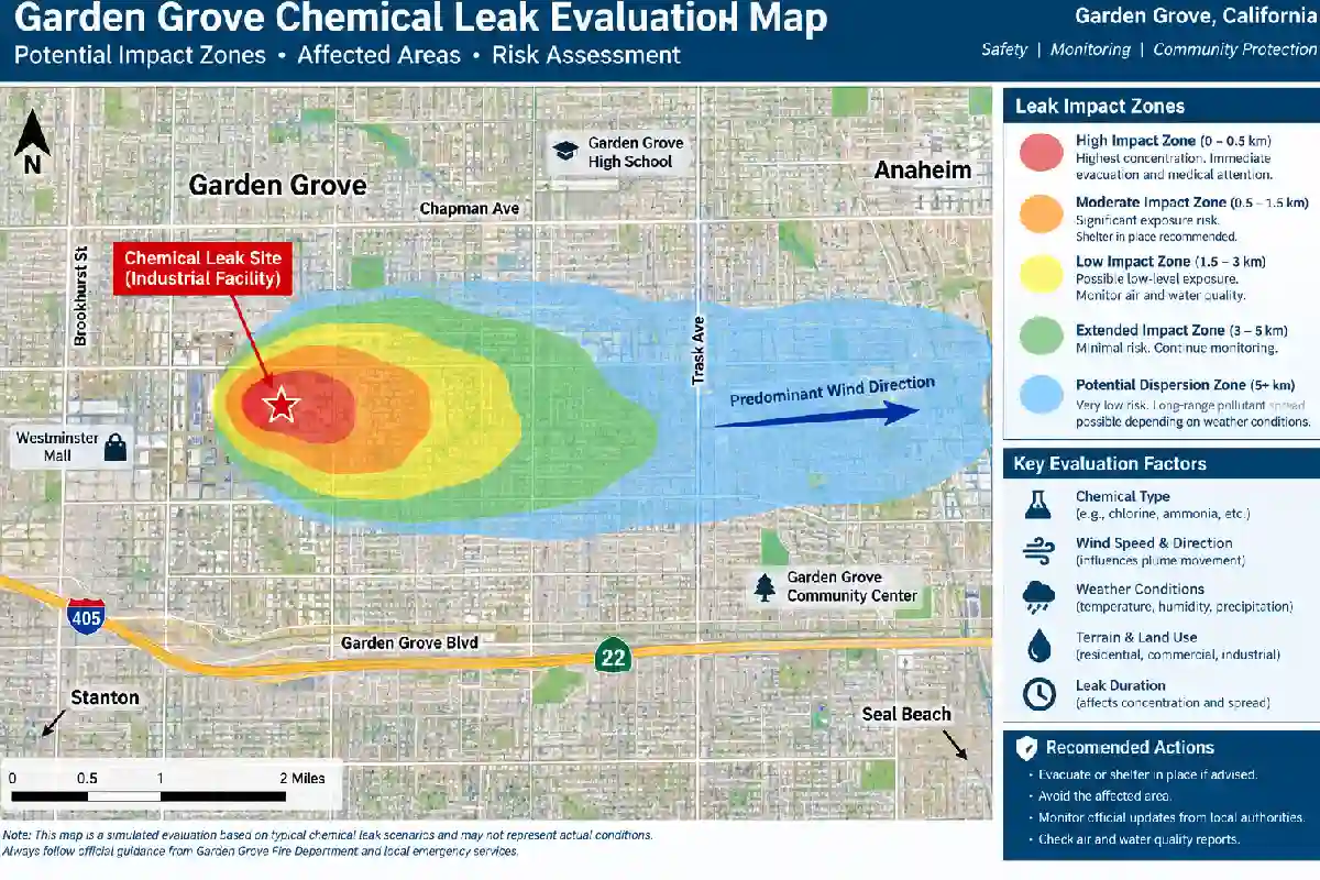
The searches for “Garden Grove chemical leak evacuation map” increased drastically when it came to the hazardous materials incident that occurred in Garden Grove, California, in May 2026. Thousands of people were evacuated due to the emergence of an emergency situation involving a tank containing industrial chemicals.
Evacuation boundaries were altered many times during the process of assessment and handling of the incident. In the process, maps became especially vital, since boundaries of the zone were initially expanded, and then decreased.
Speaking of finding any historical information on the incident, the most significant thing is that all evacuation orders related to the hazardous material incident in Garden Grove have been rescinded as of May 26, 2026. Emergency officials from Orange County said that there was no chemical leak, no threat of explosion, fire, or any danger to people.
In this paper, we will examine the Garden Grove chemical incident, its evacuation map boundaries, reasons for altering the zone boundaries, and the sources for official information.
What Happened in the Garden Grove Chemical Incident?
A hazardous materials emergency in Garden Grove occurred on May 21, 2026, within the premises of an industrial plant situated near Western Avenue, Garden Grove, Orange County.
There were concerns about the possibility of a hazardous situation due to an industrial chemical tank. The situation made it necessary for many firefighters, police officers, county authorities, and government agencies to participate in rescue operations.
According to the CAL FIRE Incident webpage, the emergency occurred at 12100 Western Avenue, Garden Grove; however, the Orange County Fire Authority was in charge of the situation.
Because of the possible hazards associated with the hazardous material, there were orders issued for the evacuation of the region near the industrial plant.
The incident lasted for several days, and the boundary of the evacuation kept changing according to the information that became available.
Garden Grove Chemical Leak Evacuation Map
“Garden Grove Chemical Leak Evacuation Map” basically implies the map that shows zones of influence of evacuation orders during the incident that happened in May 2026.
An official website was available for residents of Garden Grove in order to get more information on the hazardous materials incident. There was an evacuation zone lookup map provided there.
Official Garden Grove Hazardous Materials Incident Page
As the evacuation zone changed over time, one needs to take into account the date when the map was made.
A map of May 22 might have different boundaries compared to the map made on May 25.
Initial Evacuation Area
On the night of May 21, 2026, officials ordered residents of the zone with the following boundaries to evacuate:
- North boundary: Garden Grove Blvd
- South boundary: Orangewood Ave
- East boundary: Monarch Ave
- West boundary: Beach Blvd
People were asked to leave the affected zone due to work on stabilizing the incident. Additionally, the reunification center was organized at Rancho Alamitos High School.
Why Was the Evacuation Ordered?
Evacuations may be ordered during instances where there is uncertainty about the exact threat level posed.
During the Garden Grove incident, emergency response teams were responding to the situation involving an industrial chemical tank.
Authorities decided to be precautionary because of the possible consequences that might be associated with further deterioration of the conditions.
The reason for evacuation was based on safety measures while the issue was being addressed.
Later on, the evacuation area was expanded.
May 22: Evacuation Orders Updated
The evacuation orders were updated on May 22, 2026.
According to officials, the following areas had evacuation orders issued in relation to:
- North of Garden Grove Boulevard
- East of Springdale Avenue
- West of Dale Street
- South of Orangewood Avenue
The evacuation orders were updated by city officials due to precautionary measures in the context of containment and mitigation actions.
Expansion of the Area of Evacuation
On the same day, May 22, the area of evacuation was expanded.
According to the new order, the following areas formed the area of evacuation:
- Western Boundary: Valley View Street
- Northern Boundary: Ball Road
- Southern Boundary: Trask Avenue
- Eastern Boundary: Dale Street
This was a much larger area of evacuation.
Garden Grove Evacuation Map Boundaries
In one stage of the emergency, the boundaries of the evacuation zone included:
| Direction | Boundary |
| North | Ball Road |
| South | Trask Avenue |
| West | Valley View Street |
| East | Dale Street |
One more interpretation of the boundaries of the evacuation zone was represented in the map provided by the representatives of Orange County’s educational department.
May 25: Reduced Evacuation Zone
On May 25, 2026, the situation allowed the evacuation zone boundaries to reduce.
As reported by the City of Garden Grove, the boundaries of the evacuation zone restrict to:
- Orangewood Avenue
- Dale Street
- Garden Grove Boulevard
- Knott Avenue
The City of Anaheim declared that the evacuation zone was reduce for west Anaheim, and the evacuation order cancel there. Still, a small evacuation zone remain near the accident site.
What Did the Reduced Evacuation Zone Mean?
It meant that those places consider to be less likely to face any threats.
People in the smaller evacuation zone will keep adhering to emergency recommendations.
The reduction of the evacuation zone does not mean that the process of the emergency response is finish.
Monitoring of the situation and work in the areas near the facilities continued.
Garden Grove Chemical Leak Evacuation Timeline
Below you can see a short timeline of the key events.
May 21, 2026
The hazardous materials incident happened in Garden Grove.
The evacuation order in some areas.
They include areas between Garden Grove Boulevard, Orangewood Avenue, Monarch Avenue, and Beach Boulevard.
May 22, 2026
The second evacuation order was issue, with an increase in some areas.
The larger evacuation zone limit by:
- Ball Road
- Trask Avenue
- Valley View Street
- Dale Street
May 23 – 24, 2026
The emergency crew continue to contain and monitor the situation.
The order of evacuation was maintain in some areas.
Sheltering resources were provide.
May 25, 2026
The evacuation zone reduce.
It included reducing the zone to the area between Orangewood Avenue, Garden Grove Boulevard, Dale Street, and Knott Avenue.
How to Read an Evacuation Map
In case of emergencies, evacuation maps may become challenging.
These are some of the things one should note.
Date
In case of emergencies, the boundaries might change.
Therefore, one should always:
- Remember to
- Calculate the date
- Take into account the time
- Look at the agency making the map
The map may not reflect the latest situation.
Boundaries on Official Maps
The boundaries on the maps can mark using:
- Large highways
- Roads
- Streets
- Neighborhoods
It is advisable to interpret the map together with the official written guidelines.
Color in the Map
The colors in the emergency map can use to differentiate the zones in various ways.
For example,
- Red – for closed or restricted zones
- Green – for reopened zones
The ReadyOC map in relation to the recent Garden Grove incident used green to indicate the repopulated zone while using other colors for the road closures and exclusion zone.
What Should You Do During a Chemical Emergency?
Since the Garden Grove case is not a current evacuation emergency anymore, it can serve as an example of how such emergencies should handle.
Following Official Information
Do not trust only:
- Posts on social media
- Rumors
- Old screenshots
- Bad maps
Trust official sources only.
Leave as Soon as You Are Told to Do So
In case of an evacuation order, follow it.
Do not wait until you can see the threat or smell it.
The order may come when the situation is not yet visible to everyone.
Do Not Go to an Emergency Area
It is dangerous to go into the area where people have told to evacuate for:
- Taking pictures
- Checking your property
- Observing emergency personnel
It brings extra risks.
Monitoring Official Information
The information can change rapidly.
Follow:
- Local government agencies
- The fire department
- The police
- The County emergency agencies
Frequently Asked Questions
Where is the Garden Grove chemical leak evacuation area located?
The Garden Grove chemical leak evacuation area change during the May 2026 emergency event. The biggest evacuation area covered the area that borders Ball Road on the north side, Trask Avenue on the south, Valley View Street on the west, and Dale Street on the east.
Is the Garden Grove chemical evacuation still ongoing?
No, all evacuations as a result of the hazardous materials incident in May 2026 have lift as of May 26, 2026.
Was there a chemical leak?
In the last update of ReadyOC, Unified Command declare that there was no chemical leak and no further danger to the community.
Why did they require such a huge evacuation?
Due to concerns about a chemical storage tank, officials required the evacuation as a result of a possible emergency situation. About 40,000 people evacuate.
How many people got evacuate?
According to reports, over 40,000 people evacuate, but later reports mention about 50,000 people.
Where can I find the evacuation map?
The website of the City of Garden Grove contains the hazardous materials incident page with evacuation area maps and past updates.
Final Thoughts
The Garden Grove Chemical Leak Evacuation Map proved to be very helpful during the hazardous material incident in May 2026.
There have been many modifications to the evacuation zone during the incident. At some point, the larger evacuation zone was from Ball Road to Trask Avenue and Valley View Street to Dale Street. The zone was gradually reduce until there were no more evacuation orders on May 26.
One must be aware, when conducting research regarding the incident, of the difference between previous evacuation maps and current emergency instructions.
The evacuation in May 2026 has now deactivate. The emergency update has announced that there are no more evacuation orders because there is no longer a threat to the community.
For any other emergency, it is important to refer to the official website of the city, county, Fire Department, and Emergency Management.
